US Army Corps of Engineers
Coastal Inlets Research ProgramCoastal Navigation Portfolio Management
The Coastal Navigation Portfolio Management work unit works to develop novel key performance indicators that augment legacy metrics for managing the coastal navigation portfolio. These key performance indicators are objective, quantitative, systems-based, and derived from data generated by waterway users via the Automatic Identification System (AIS) and other sources.
Underkeel Clearance-based Metrics
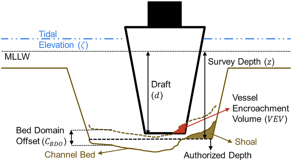
By fusing NOAA's water level data, USACE bathymetric data from eHydro, draft data from Customs and Border Protection, and vessel position data from AIS, the underkeel clearance of vessels transiting maintained waterways can be measured. This represents users' demand for depth that USACE supplies through dredging. The novel capability to estimate demand provides USACE the capability to accurately provide depth where it is needed, instead of where tonnage is highest.
Journal Publications
- Ranking Ports by Vessel Demand for Depth
- Evaluating the Underkeel Clearance of Historic Vessel Transits in the Southwest Pass of the Mississippi River
Coastal Structure Portfolio Analysis
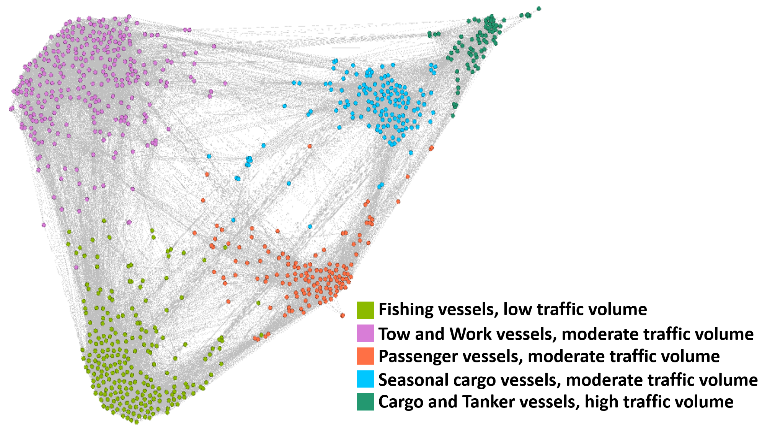
By analyzing the behavior of vessels near coastal structures and environmental factors affecting structures, it is possible to classify every structure into a management cohort where traffic behaves similarly. By classifying structures this way, it is possible to manage structures as similar assets within an asset class, instead of a collection of unique structures. Appropriate maintenance activity can be directed to where they're most needed, instead of where tonnage is highest.
Journal Publication
Coastal Structure Sheltering Metrics
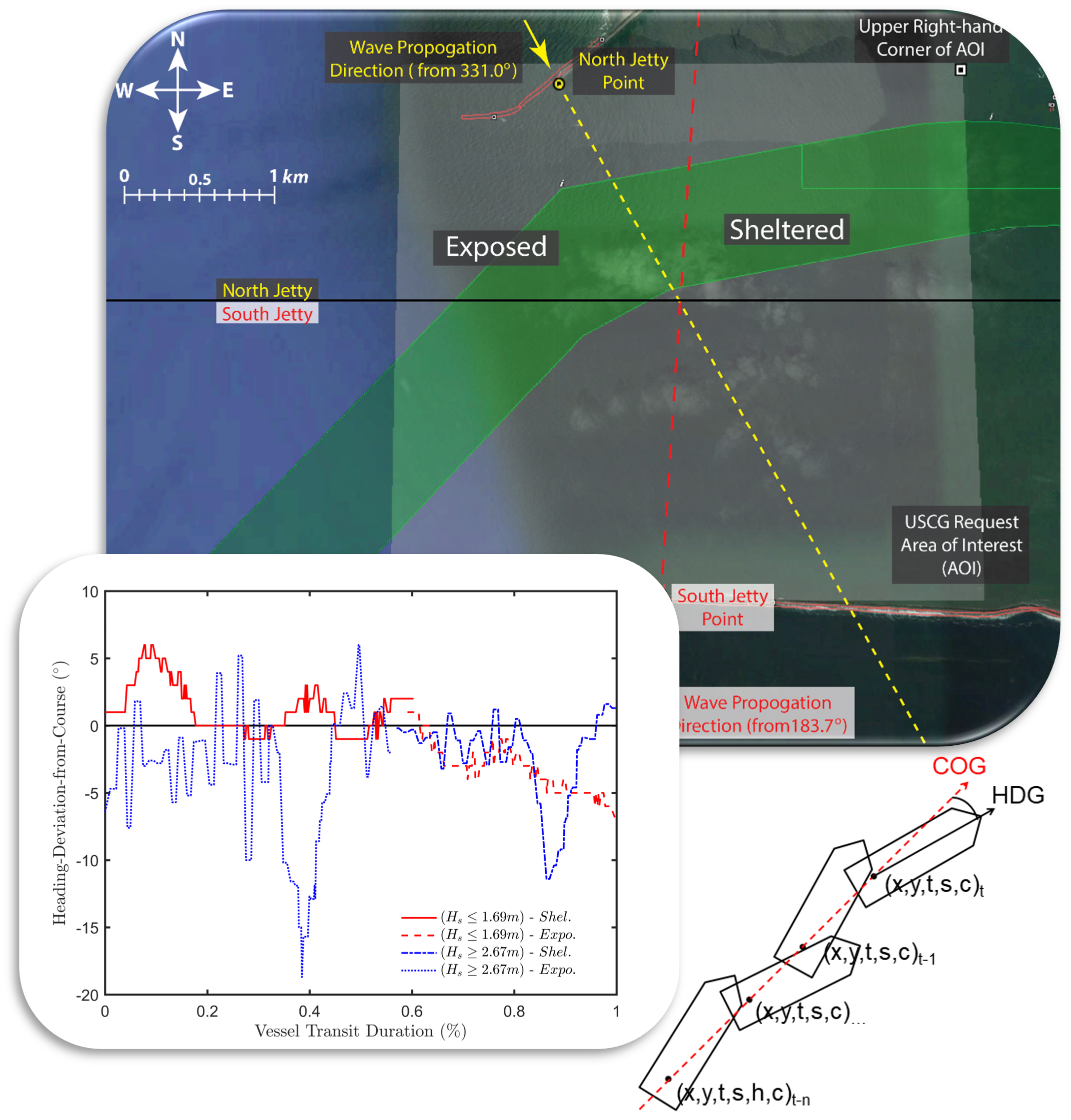
By observing the momentary attitude of vessels in transit relative to their course over ground, it is possible to measure how coastals structures are performing. By tracking this metric over time, it is possible to determine the rate at which their performance degrades. This in turn provides insight as to which structures are most in need of repair.
Journal Publication
Other Papers/Reports and Miscellaneous
| Title | Type | Links | |
|---|---|---|---|
| Episode 29 – Underkeel Clearance: Quantifying demand for USACE dredging | Podcast | https://poweroferdcpodcast.org | |
| Managing Navigation Channels with Observed Vessel Usage | Coastal Sediments 2023 | Paper | Presentation |
| U.S. Port Connectivity and Ramifications for South Atlantic Division Ports | ERDC Special Report | ERDC Library | |