
US Army Corps of Engineers
Coastal Inlets Research ProgramCoastal Modeling System (CMS)
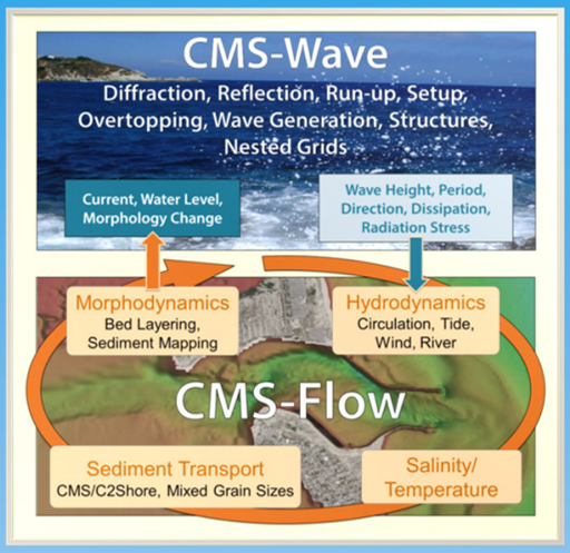
The Coastal Modeling System is an integrated 2D numerical modeling system for simulating waves, current, water level, sediment transport, and morphology change at coastal inlets and entrances. Emphasis of the CMS is on navigation channel performance and sediment exchange between the inlet and adjacent beaches. A key objective of this work is to develop, test, and transfer the CMS to Corps Districts and industry for use on specific engineering studies.


CMS 5.4 - Current Release is CMS2D_v5.4 (Update 6) - 3 July 2025
Check wiki page for latest version
Features
- Interface: Surfacewater Modeling System (SMS) version 13.4
(should work with SMS 13.0+ and reduced functionality with SMS 11.2). - Combined Implicit and Explicit solution schemes into one executable:
- Cartesian and Quadtree (telescoping) grids available for CMS-Flow
- Cartesian grid type available for CMS-Wave
- New CMS-Flow Features in SMS 13.4+: New
- Interfaces for Weirs, Culverts, Tidal Gates.
- Rubble Mound structures are available in SMS 13.1+.
- New Hardbottom Dataset coverage and tool
- Sediment Mapping capability
- Documentation forthcoming.
- Contact Honghai Li for information.
- New SMS interface for CMS-Wave (v3.4) in SMS 13.2+
- New Model Control and simulation capability.
- Easier to read parameter file format (.std).
- Numerous bug fixes and parallelization improvements.
Latest version of the code is always available from the CIRP Wiki page listed below:
Please note the Terms and Conditions for the Coastal Modeling System
CMS-PTM version 2.0.55 – Executable
| Documentation | CMS User's Guide (2024 Update)  CIRP Wiki - General CMS Wiki Page CMS Documentation Portal |
| Validation Report Test Case Files | CIRP Wiki - Validation Test Cases |
| Validation Cases Documented | CIRP Wiki - Other Test Cases |
| Workshops | List of All CIRP Workshops (including CMS) |
| USACE users | SAM, SAJ, SAW, SWG, NAN, NAB, NAP, NAE, LRB, LRE, NWS, NWP, SPN, SPL, POH, POA |
| Recent CMS/C2Shore Poster | 2024 CWG Meeting, Vicksburg, MS |
Points of Contact
| Honghai Li | cirp@usace.army.mil |
| Mitch Brown | |
| Lihwa Lin | |
| Liz Holzenthal |
Last Updated: 2026-10-05